


First thing to note is warning. Never start trekking the volcano when the Meteorology and Geophysics Board issues a warning - which is not uncommon. Often times, primary danger may come not from Semeru but from the neighbouring Bromo. Nevertheless, as these two volcanoes and several others in Bromo Tengger Semeru National Park are close to each other, it is wise to consider any warning.
Trekking Semeru is no easy matter and a long journey. You can start from Lumajang or Malang but you will end up in a bus terminal at a certain Tumpang Village. From here, there is no mass transportation except jeep and vegetables-carrier trucks, with fare about IDR 20,000 ($2). This will take you to Ranu Pani Post, but first you have to visit Gubugklakah to obtain entrance ticket, permit and insurance.

Ranu Pani is the last village at the foot of Semeru. You will be checked for belongings and are subject to more fees: tent is IDR 20,000 and camera IDR 5,000. Hiring a porter is also possible here. At Ranu Panu, on an altitude of 2,200 above sea level, you can also enjoy two inland lakes, namely Ranu Panu (1 ha) and Ranu Regulo (0.75 ha). Passing the gate, take the road to the left.
This is a 5-km meandering track dominated by reeds. No direction sign except distance measure every 100 m. At the end of the trail is Watu Rejeng, a steep rock from where one can see beautiful scenery comprises of valleys and hills with pine forests. Once in a while, you can also see smoke rising off the caldera. The next point is another inland lake, Ranu Kumbolo, about 4.5 km from here.
At 2,400 above sea level, Ranu Kumbolo is a 14-ha lake with clear water and live fish. Here you can add your drink provision with water from the lake. Leaving the lake, you enter a wide field called Oro-oro Ombo. The field, green with grass, is surrounded by hills and smaller volcanoes. Next is a point called Cemoro Kandang, a home to many kinds of birds and antelopes. Kalimati is the next point where you can take a rest for a while.

From Kalimati, you will continue through a soft and steep track that leads to Arcopodo, the last vegetation area of Semeru, stretching on 2,900 above sea level. After this, there is only hills made of sand. Leave your things behind at Arcopodo to start the ascend to Jonggring Salokoa, Semeru's caldera, at 2 in the morning.
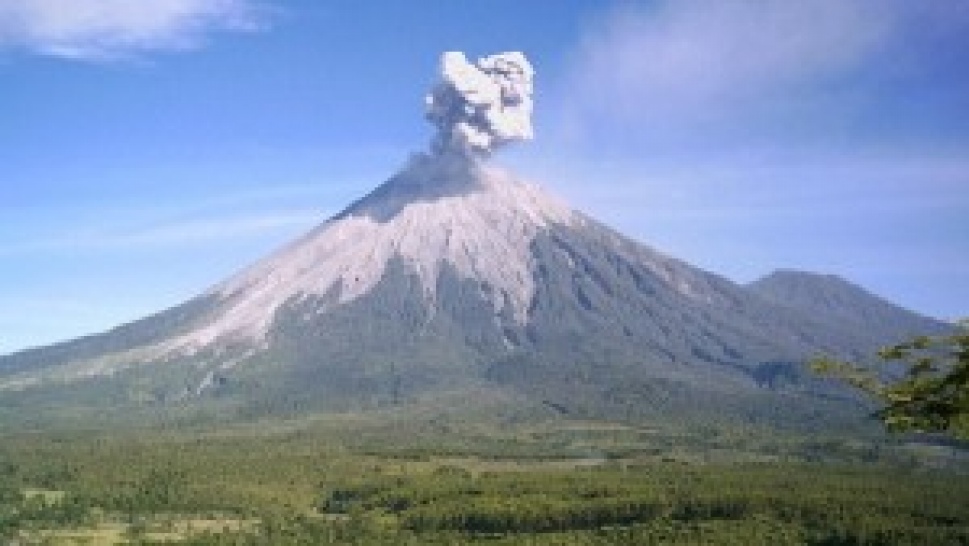
During the day, wind sweeps to the north, bringing deadly gasses from the caldera along. Safest months for climbing is June to September, or during the dry season, as there are storms and landslides during the wet season. Once you get near to it, you are prohibited from closing the crater from the southern slope due to lava track and deadly gass (aptly called "Wedhus Gembel" or "Wild Goat" by locals).
Temperature can be as low as 4-10 degrees and crystals often appear during the dry season. The fiery Wild Goat starts once in every 15-30 minutes. In November 1997, it was recorded that Semeru fumes 2990 times in a day. The legendary student activist Soe Hok Gie died in the 1970s here because of Semeru's volcanic gasses.
Share the News